The ruins of Caracol, the largest known Maya site in Belize, were lost in the rainforest for several centuries until their rediscovery by
chicleros in 1936. They were first systematically explored by A H Anderson in 1938: he named the site Caracol--Spanish for "snail"--because of the large numnbers of snail shells fround there. Caracol covers more than 3/4 km with at least 32 large structures and 12 smaller ones around 5 main plazas. This is the largest pyramid, Canaa, the tallest known in Belize at 42m. The dates on stelae and tombs suggest an extremely long occupation, with the population peaking at the height of the Classic period, around 700 AD. Glyphs carved on altars tell of war between Caracol and Tikal, with power over a hugh area alternating between the two great cities. One altar dates Caracol's victory over Tikal at 562 AD -- a victory that set the seal on the city's rise to power. --
The Rough Guide
卡 拉酷 Caracol 是伯利兹 Belize 境内所知规模最大的玛雅遗址,几个世纪以来一直隐秘在中美洲的热带雨林中。1938年发现,起名为卡拉酷,意思是“蜗牛”,因为在附近发现很多蜗牛壳。卡 拉酷这里至少有五个广场,32座大型建筑,12个小型建筑。最大的金字塔卡纳 Canaa,是伯利兹境内最高的,达42米。卡拉酷国鼎盛时期在公元 700年左右,据记载曾经战胜过 Tikal 国。
Early in the morning we had breakfast at Pop--a local restaurant recommended by our guide of the day--Enald. Met our tour memeber Inge, a young Dutch tour guide who is taking a few days for herself after her work.
Our guide, or rather our driver, is a stout built local whose family owns a nice cabana resort near town. His 4WD is a 1990 but very well-maintained. He told me that most cars in Belize were bought used by the Mexicans from the US and sold in Belize. His car cost $4000BZ, a great deal. He had lived with the Mennonites, the religious people moved from Germany in 1950s and now farm and live self-sufficient life here in the area. Enald learned mechanics with them. Other than cars, he talked minimum, making him an almost hostile guide.
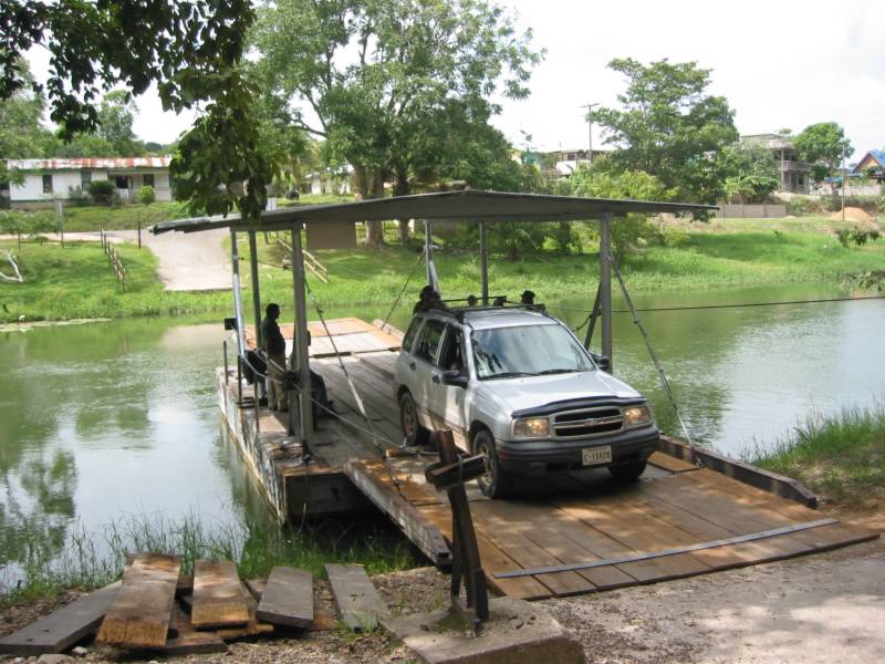
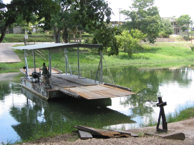
The road to Caracol goes through the Mountain Pine Ridge where we passed a few days ago. The road gets more and more difficult the further south we go. Crossing a river, the vegetation changed suddenly from pine trees to tropical plants. In the thick tropical forest, we arrived at the Caracol Maya site. Our guide there is Gustavo from the department of archeaology--a park warden.
玛雅遗址卡拉酷在深林中,由 Cayo 开车去,要在山里走三个多小时。
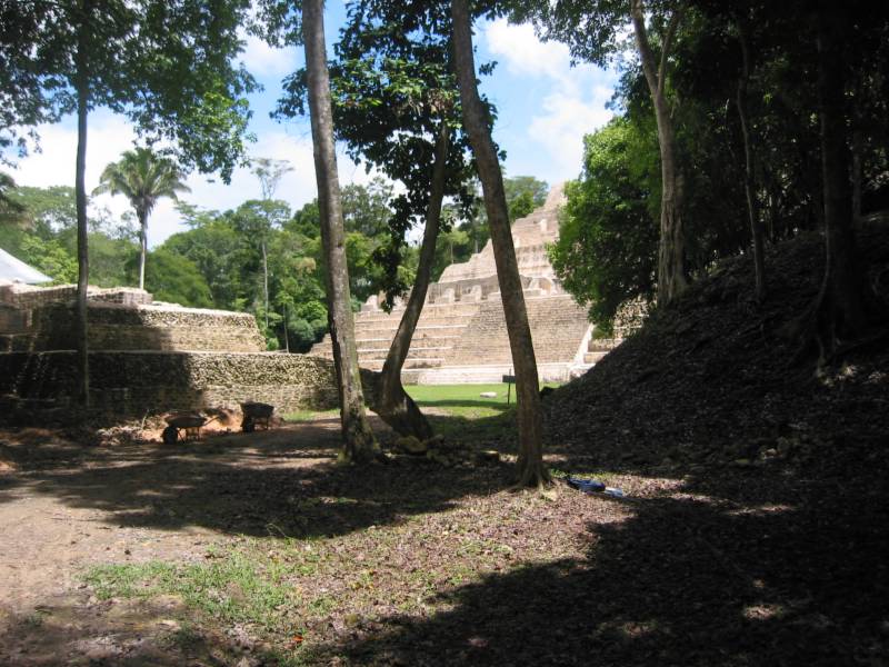
First we learned about excavation work. As we walked down a path, the small mounts of tall trees are actually Maya structures, buried under the earth and thick vegetation after hundreds of years. Some stones have been uprooted by trees. It's impossible to see the shape of the original strucutres, but we can tell the size.
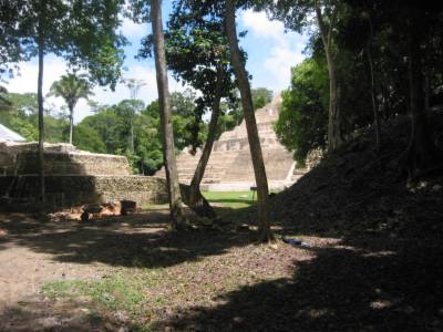
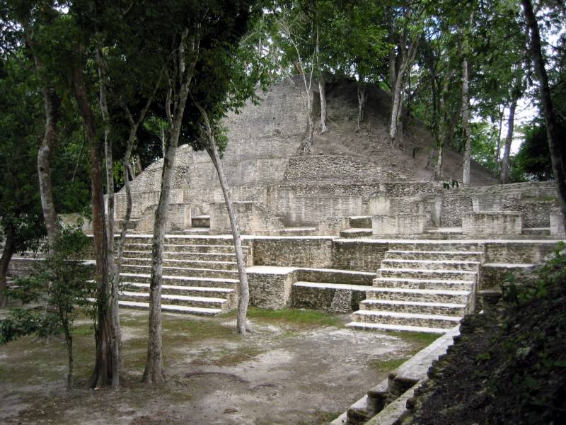
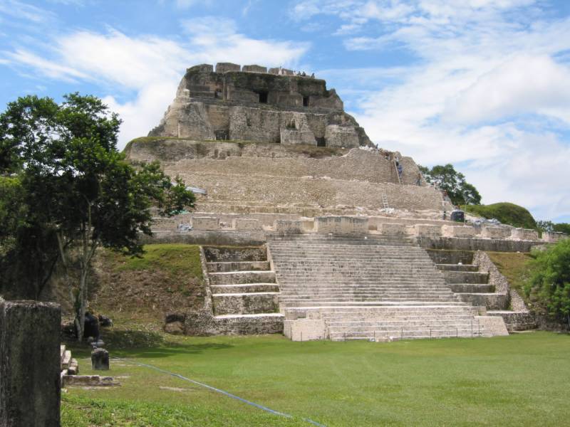
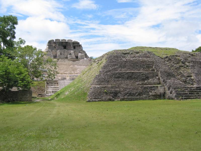
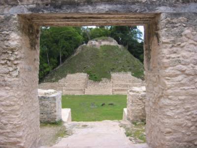
Seeing the pyramids for the first time. The one in the distance is Canaa, the tallest in Belize. The structure on the right has not been excavated. I mistook it as a small hill at first.
远处的是卡纳金字塔,伯利兹境内最高的。左侧是正在发掘的建筑,右侧小山坡也是一个建筑,被几百年的热带雨林埋没了。
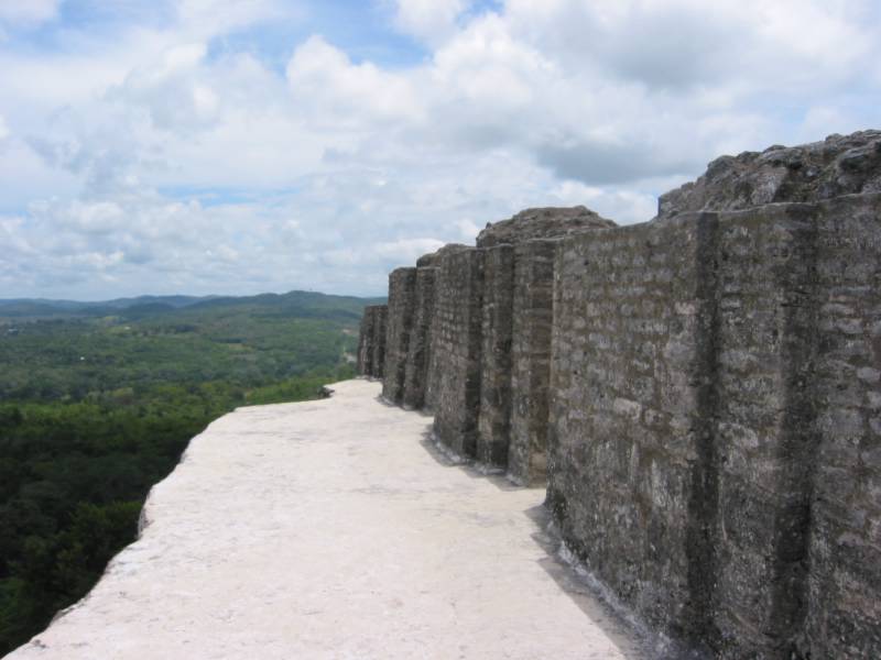
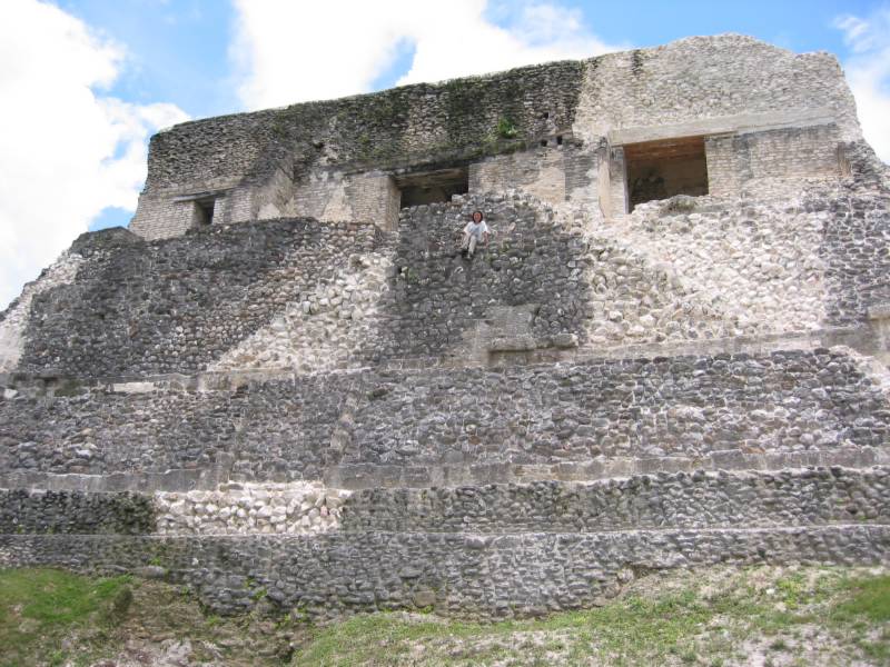
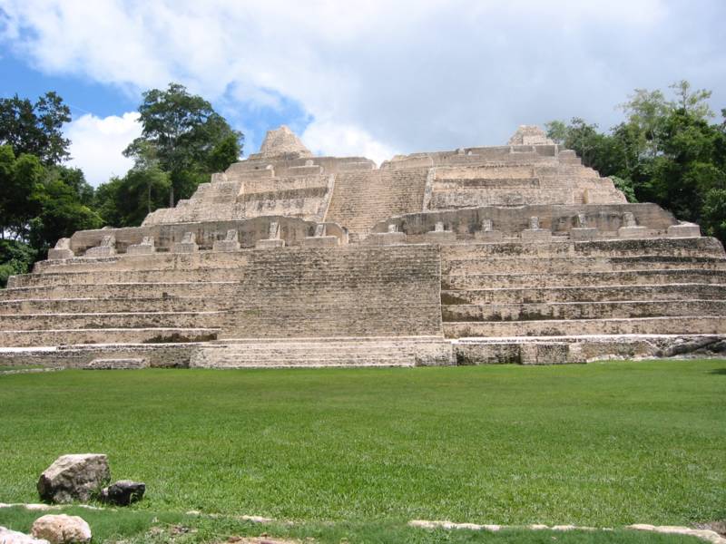
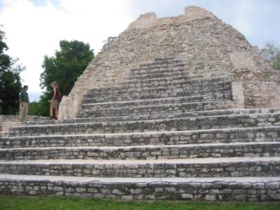
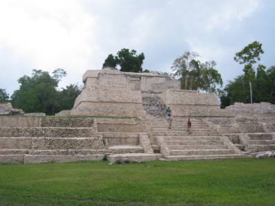
Caana is the main structure of Caracol. It is the tallest Maya building in Belize, 42 m hight. It is a beautiful, massive structure in white stone, pyramid in shape but not overly steep. This is where royal family used to live. I don't know why they prefer to live on top of all those many steps. From the top the view is tremendously vast. Miles and miles of green canopy.
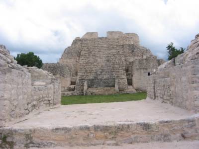
Canaa of Caracol, the tallest pyramid known in Belize, 42m high.
卡纳大金字塔。
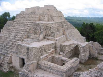
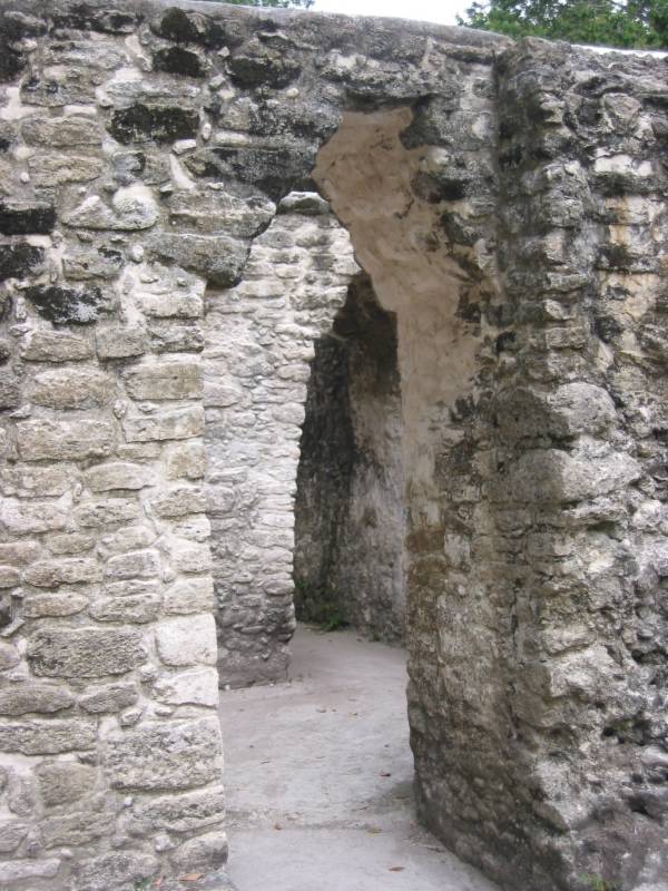
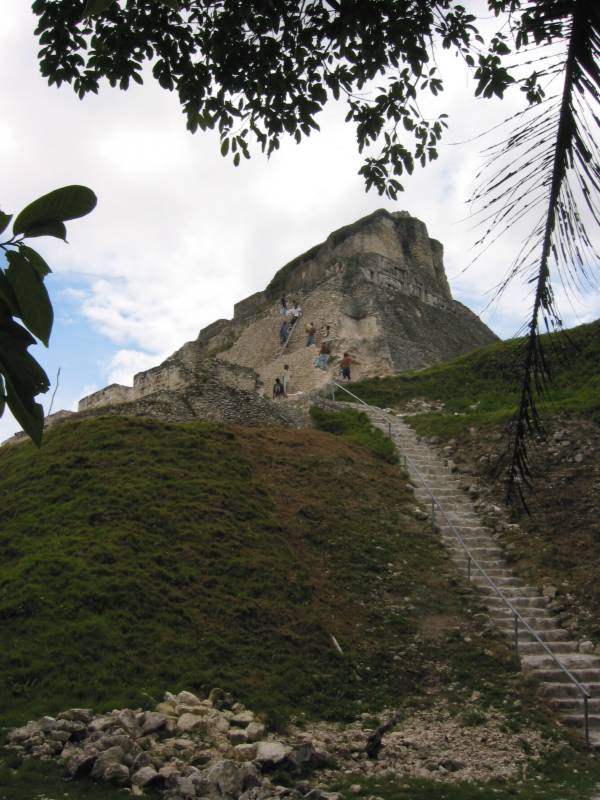
Canaa of Caracol, the tallest pyramid in Belize. Note the doorways and the basement entrance. Beneath Canaa a series of looted tombs still have traces of the original painted glyphs on the walls.
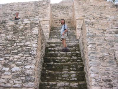
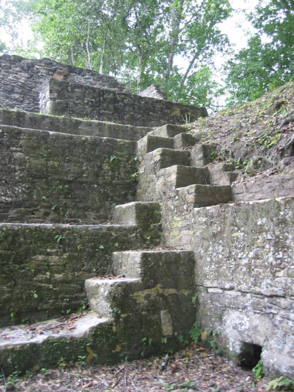
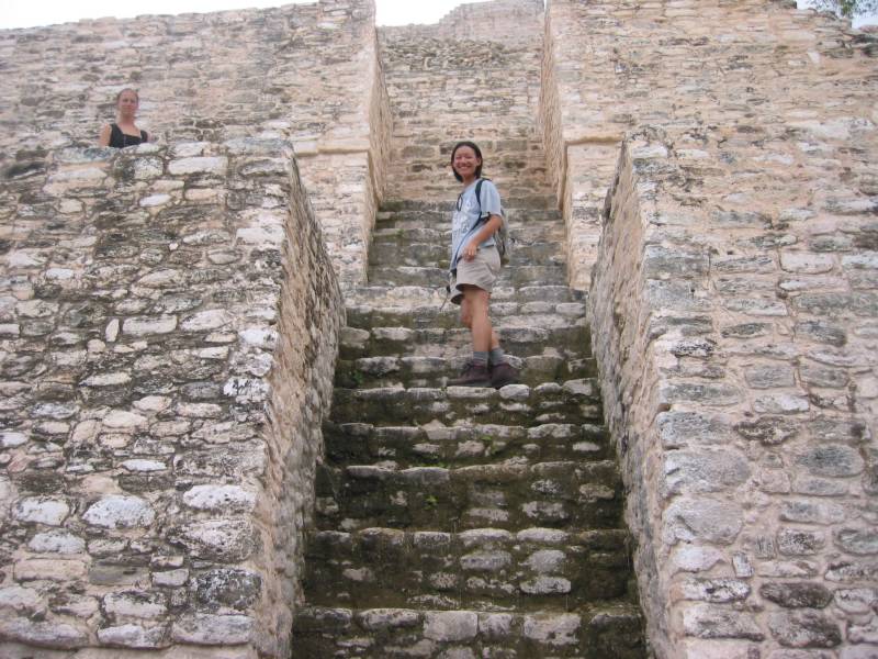
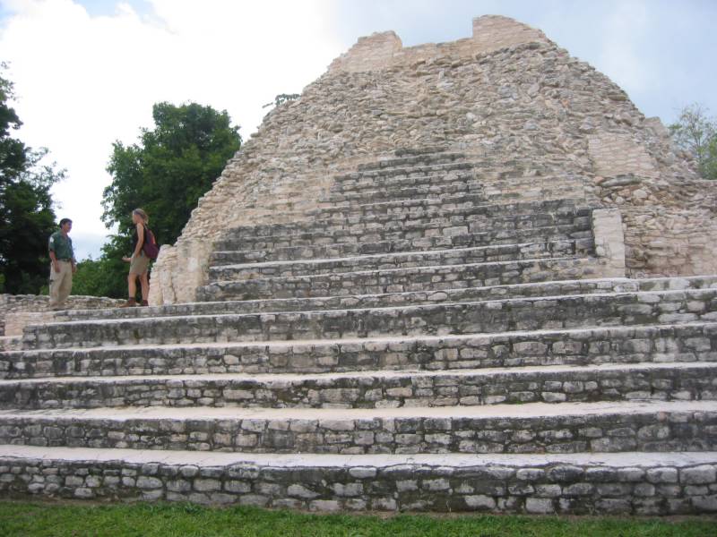
Steep steps going up Canaa of Caracol, the tallest pyramid known in Belize.
卡纳金字塔的台阶很陡。王亲贵族曾住在塔上的小屋里。我想不到他们每天如何爬上爬下。
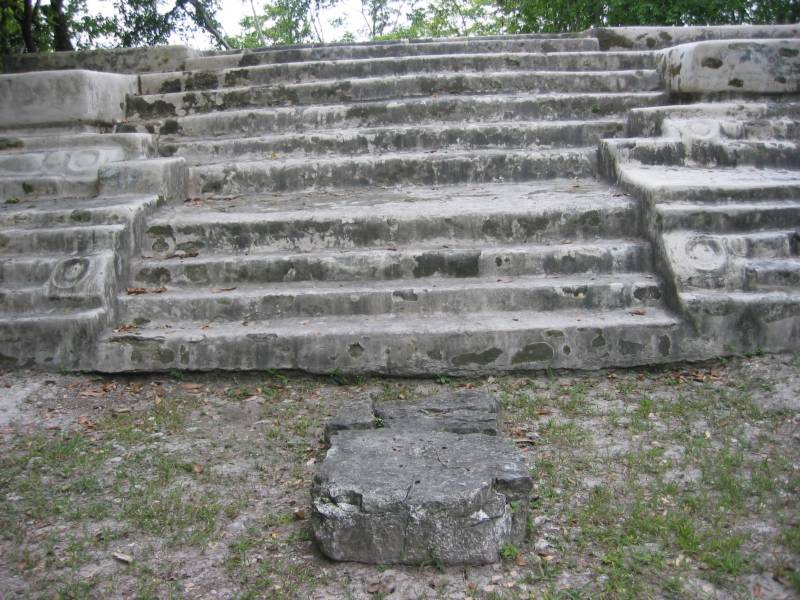
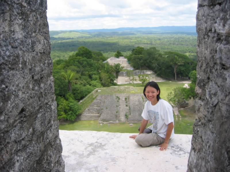
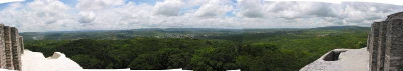
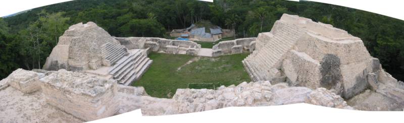
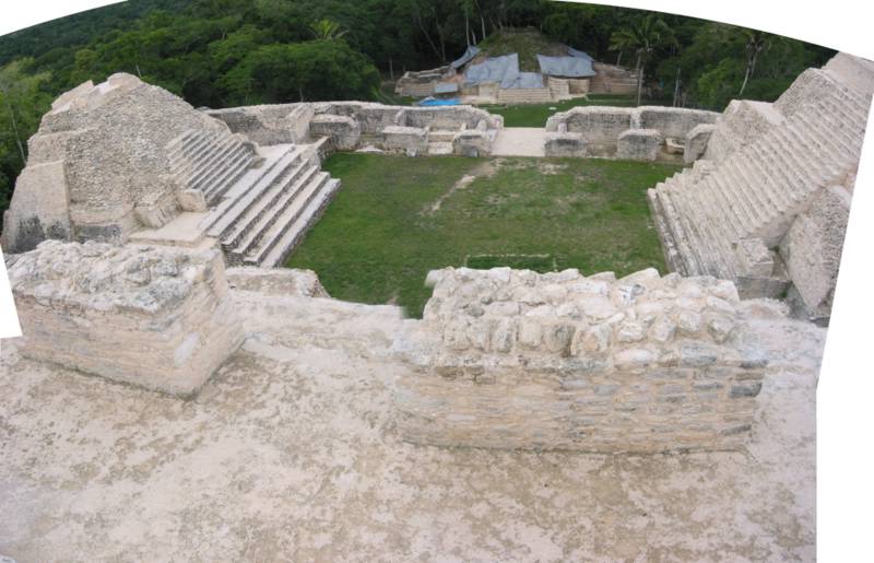
View of the plaza from the top of Canaa, the tallest known Maya pyramid in Belize. At the top of this freshly restored structure is a small plaza; an altar here has revealed sings of a female ruler.
从卡纳金字塔顶向下望,广场及建筑。远处的建筑正在发掘。

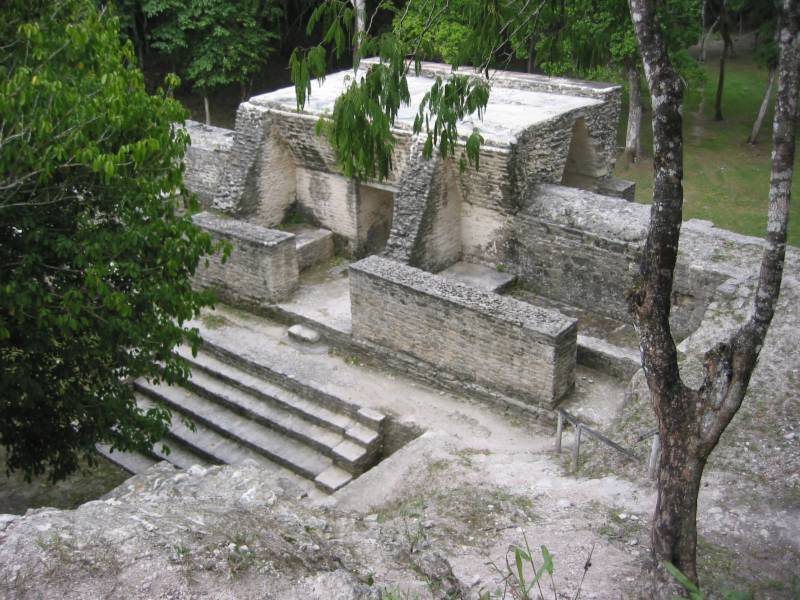
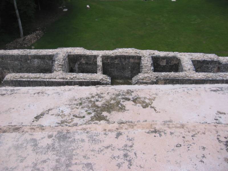
A group of rooms at the pyramid Canaa, view from above.
卡纳金字塔基层的一些房间。

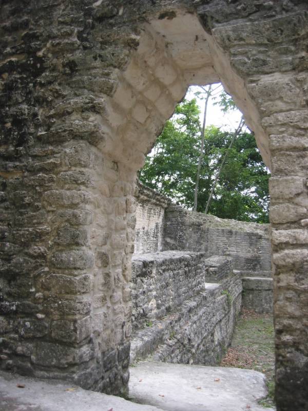
The plaza view from the top of Canaa. The pyramid in the distance is being excavated.
由卡纳金字塔顶望下,是广场。玛雅国王在金字塔顶举行祭奠仪式。

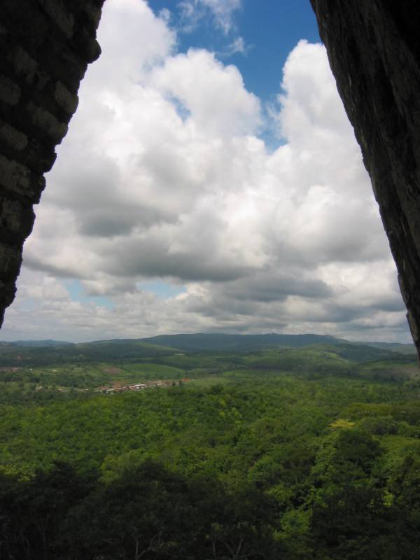
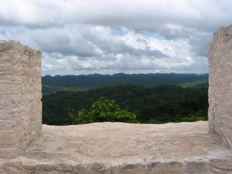
The view behind Canaa at Caracol, Belize. Only jungles.
卡纳金字塔顶向外望去,是无际的丛林。不远处就是危地马拉。
"It is an amazing experience to be virtually alone in this great abandoned city, the horizon bounded by jungle-covered peaks, through which it's only three hours on foot ot Guatemala." -- Whatmore and Eltringham,
The Rough Guide, Guatemala & Belize.
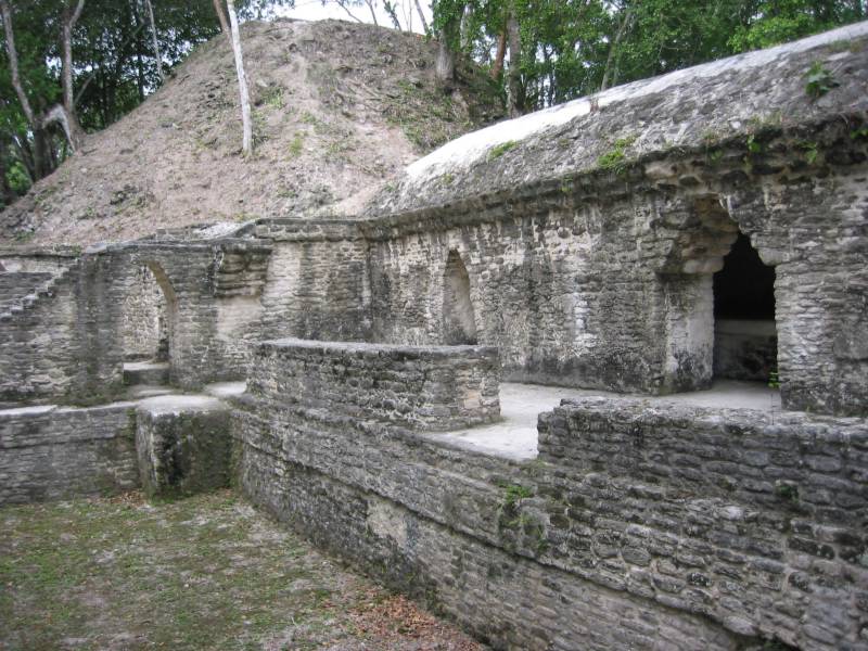
A pyramid next to Canaa.
卡纳金字塔旁的建筑。

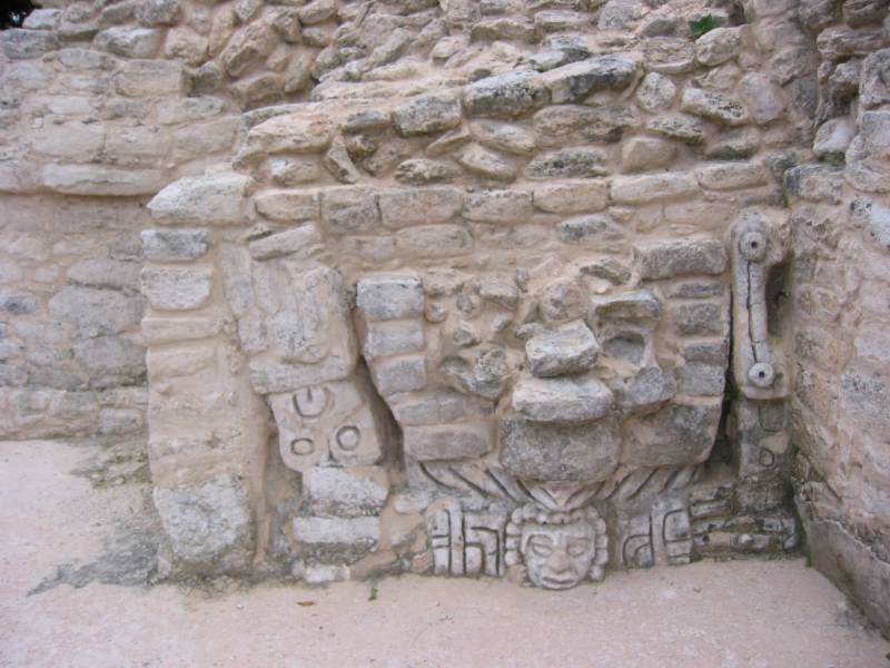
Carvings on the pyramid next to Canaa.
金字塔上的石刻。
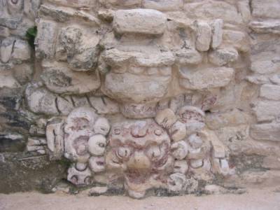
Carvings on the pyramid next to Canaa. The red color is original, if I remember correctly.
金字塔上的石刻。
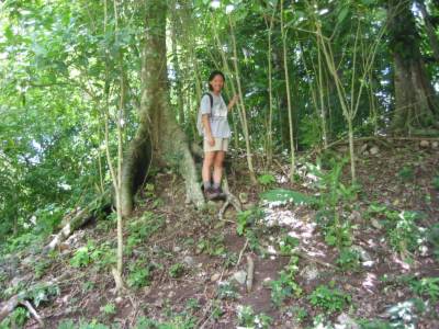
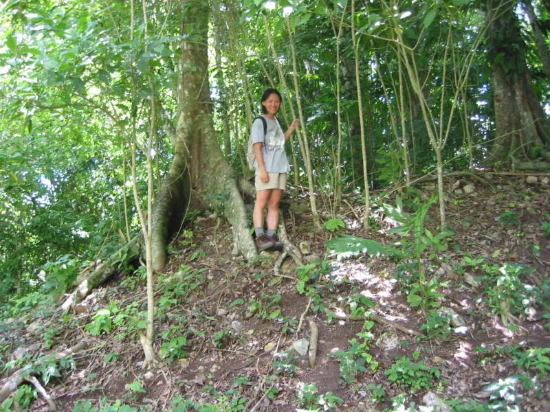
I am standing on a mount, but there is a Maya structure underneath. Some stones can be seen being uprooted by the jungles in the last 500 years. Caracol, Belize.
站在小山坡上,脚下是玛雅遗址,未曾开掘。几百年来,树木将建筑掩盖,树根将石头翻出来。
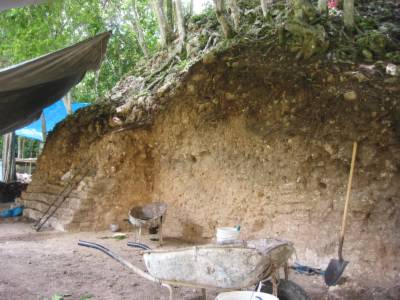
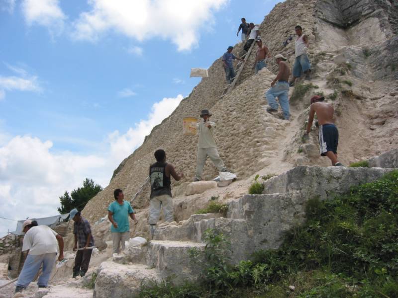
Excavation and restoration of a pyramid structure (the one seen in front of Canaa). The first step is to find where the edge of the structure is. Caracol, Belize.
正在发掘的建筑,在卡纳金字塔前侧。
We visited the ball court, the reservoir, the temple, the plazas, the tombs, the looter's demage, the residential structures, the stelae. All I have read in books are now in sight. The warden told us that of the 19 some stelae found in this site, only 2 remains here, the rest being scattered around the world in museums. Some countries gave Caracol pexiglass replicas of the originals. It is a complicated issue of whether the originals should be kept by the locals, because here in Caracol, the artifacts (stone carvings) are on display in a thatched roof hut where everyone can touch, or even demage them.

Ballcourt in Caracol, Belize.
卡拉酷的球场。

A tree grows on top of the ballcourt structure in Caracol, Belize.
卡拉酷的球场上的一棵树。
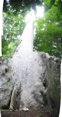
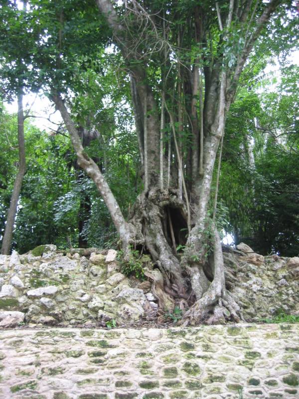
An 700-year old ceiba tree--sacred to the Maya--with enormous buttress roots twice as high as a human being. See my bag at the bottom of the tree for size comparison. Caracol, Belize.
七百年的大树,极高无比。树下的包是我的。
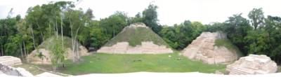
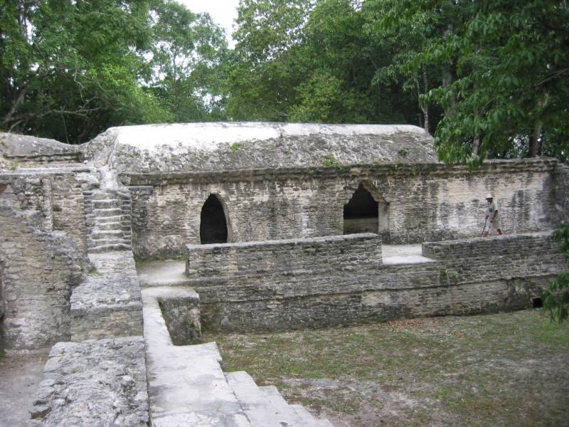
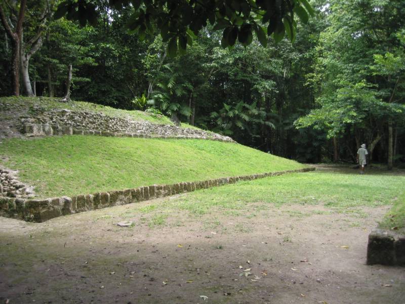
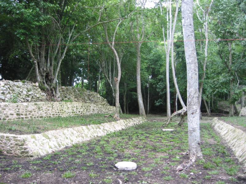
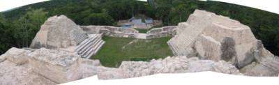
A second group of pyramids and plaza in Caracol, Belize.
卡拉酷玛雅遗址的另一组金字塔与广场。
Going up the main pyramid of the second group of structures. Caracol, Belize.
第二组金字塔群的建筑。
On top of the pyramid of the second group of structures. The wood logs above the door was original--700 years ago! Caracol, Belize.
门顶的木梁仍是玛雅人当年的木头。考古学家不知道这段木头为什么能保存如此好。
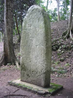
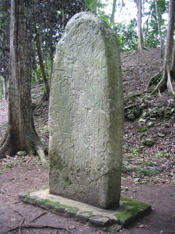
A stela in Caracol, but this one is NOT real. It's pexiglass. The original is in a US university.
卡拉酷的一座玛雅石碑。可惜这是塑胶仿制品。原件在美国一所大学里。

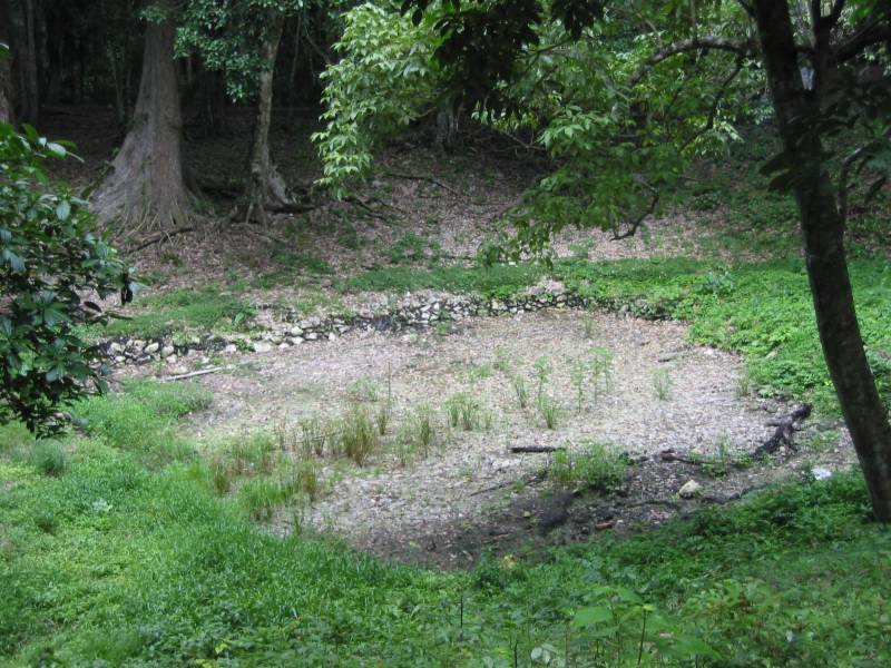
The Maya-built reservoir is still used when the archeologists are in residence.
当年玛雅人所建的水库,至今考古学家们还在用。

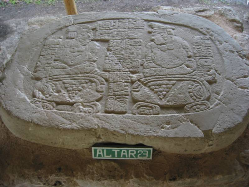
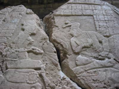
Maya altar in Caracol, Belize. Two boun captives with a row of glyphs above and between them. It has been dated at 810 AD.
公元810年的一块石板,刻有两个战俘,一些玛雅图形文字。
Maya altar broken by logging tractors in the 1930s. Caracol, Belize.
被伐木拖拉机故意破坏的一块玛雅石板。

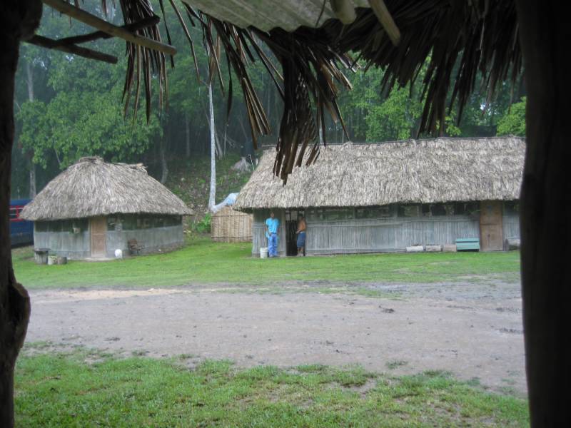
Thatched roof huts in the rain, with evacuation workers in Caracol, Belize.
芭蕉叶的小屋,雨中,工人。伯利兹的卡拉酷遗址。

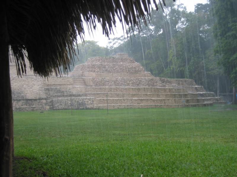
Rain, thatched roof, pyramid, in Caracol Maya site, Belize. A typical day.
雨中卡拉酷玛雅古城旧址。
It was raining hard. Our driver guide picked us up and we drove back to Rio Frio Cave to take a peek, then the Rio On Pool. Inge and I swam in the higher pools of the falls. The drive back was quite bad. Boring and full of tension among all of us. I couldn't get an conversation with anyone so I quitted. Just sitting in the back anxiously the whole time. Back in town we had dinner at the veggie place, and I drank Jack Ass Bitter tea.